You may walk into geography class thinking sea level change works like a bathtub filling up. Water rises everywhere equally, right? Wrong. And that misconception creates the perfect learning moment. The lightbulb switches on when you discover that Scotland’s coastline is actually rising while southern England’s is sinking: same island, opposite effects.
This revelation opens the door to understanding the three fundamental types of sea level change that every A-level Geography student must master. Each operates differently, and recognising these differences transforms how you approach coastal geography.
Eustatic Sea Level Change
Eustatic changes represent true global sea level fluctuations. When students hear “sea level change,” they immediately jump to melting ice caps. They’re partially right, but missing the bigger picture.
Melting ice does contribute significantly. Greenland’s ice loss jumped from 34 billion tons annually in the 1990s to 247 billion tons between 2012-2016. That’s a seven-fold increase in two decades. But here’s what surprises students: thermal expansion now dominates the story. As ocean water warms, it expands. In 2024, two-thirds of sea level rise came from expanding ocean water, with only one-third from melting ice.
This shift matters for exam answers. You need multiple factors in your toolkit, not just the obvious ones. Ocean basin volume changes also drive eustatic fluctuations. When seafloor spreading rates increase, volcanic activity displaces water upward. When spreading slows, sea levels drop as water returns to enlarged ocean basins. These processes operate on geological timescales, but their effects shaped the coastlines students study today.
Isostatic Sea Level Change
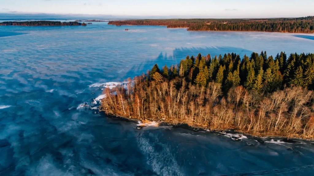
The seesaw analogy transforms how some students grasp isostatic adjustment. Heavy ice sheets once pressed down on Scotland like someone sitting on one end of a seesaw. When that ice melted 20,000 years ago, Scotland began bouncing back up. The south tilted down in response.
This process continues today. Northern Britain rises at 1.5mm per year while southern Britain sinks at 1mm annually. The UK literally pivots on a geological fulcrum. It can be easy to connect this to physics you already understand. Remove weight, and compressed materials rebound. Add weight, and they compress further. The same principle applies beyond ice sheets. Massive sediment deposits can depress land surfaces. Large-scale water storage behind dams creates similar effects. Volcanic loading from major eruptions triggers isostatic responses.
The key insight: isostatic change involves land movement, not water volume changes. Students often confuse this distinction in exam questions.
Tectonic Sea Level Change
Tectonic processes alter sea levels through two main mechanisms: changing ocean basin volumes and moving coastlines vertically.
Ocean basin volume changes occur when plate tectonics reshapes the seafloor. Faster spreading creates younger, warmer oceanic crust that sits higher. This displaces water upward, raising global sea levels. Back-arc basin formation can contribute up to 120 meters of sea level change. Major volcanic episodes add another 45-75 meters through seafloor displacement.
Vertical land movement happens at plate boundaries. Subduction zones can rapidly uplift or depress coastlines. Transform faults create step-like elevation changes along coasts. These changes operate slowly compared to human timescales, but they’ve made the dramatic coastal variations geographers observe in case studies worldwide.
Relative Sea Level: What Communities Actually Experience
Relative sea level change combines all previous effects into what coastal communities actually measure and experience. This represents the observable reality. Tide gauges record relative changes, not individual components.
Regional variations can be dramatic. While global average sea level rises, some locations experience falling relative levels due to strong isostatic rebound. Others face accelerated rise where land subsidence combines with eustatic increases. You need to understand this distinction for case study analysis. London’s Thames Barrier responds to relative sea level change, not global averages. The Maldives faces different relative pressures than Alaska’s rebounding coastlines.
Relative measurements drive coastal management decisions, flood defence planning, and habitat conservation strategies.
Building Your Understanding
Learning these concepts successfully requires systematic progression. You need individual understanding before seeing interactions.
- Start with misconceptions: Address the bathtub thinking directly. Use the Scotland-England example to shatter uniform assumptions.
- Build the factors toolkit: You need multiple causes for each type, not just the most obvious ones. Exam questions reward comprehensive factor knowledge.
- Emphasise measurement distinctions: Eustatic changes affect global water volumes. Isostatic changes move land surfaces. Relative changes represent observable coastal reality.
- The seesaw analogy works because it connects unfamiliar geological processes to familiar physics.
- Focus on timescales: Eustatic changes from thermal expansion happen within decades. Isostatic rebound continues for millennia. Tectonic changes operate across millions of years.
You can learn more about sea level change, its impacts and specific examples as part of our coastal systems and landscapes course for A Level Geography students. Study Dog’s resources allow you to learn in a variety of methods: flashcards, notes and audio resources.